A team of archaeologists has identified what may be the world’s oldest known three-dimensional map, according to a new study.
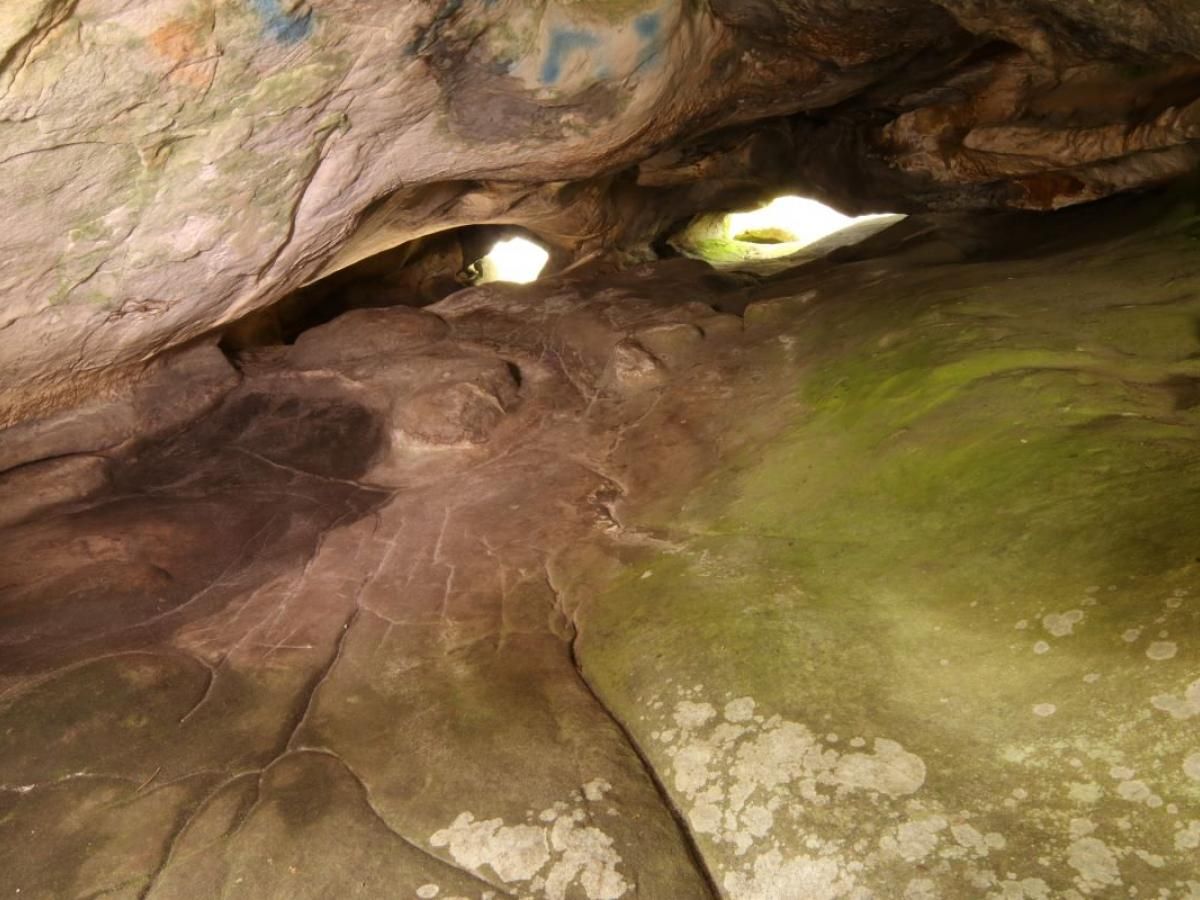
The discovery was made at Ségognole 3, a prehistoric sandstone rock shelter located south of Paris, France. While the site has been known since the 1980s for its ancient engravings—including depictions of two horses flanking what researchers call a “sexual figuration” (a symbolic representation of female anatomy)—a newly revealed feature suggests an even more remarkable use of the space.
In a study published in the Oxford Journal of Archaeology, researchers describe an engraved section of the shelter’s floor that appears to be a miniature topographical representation of the surrounding landscape. If confirmed, this would be the earliest known 3D model of a Paleolithic territory, created roughly 13,000 years ago.
A Unique Paleolithic Map
The Paleolithic period, also known as the Old Stone Age, spanned from about 3.3 million years ago to around 12,000 years ago and was the longest phase of human prehistory. According to the researchers, the engravings at Ségognole 3 were not designed as a map in the modern sense—showing distances and travel times—but rather as a 3D depiction of natural water flows and landscape features.
“What we've described is not a map as we understand it today,” explains Anthony Milnes, a co-author of the study from the University of Adelaide. “Rather, it is a three-dimensional miniature illustrating how the landscape functions—showing highland runoff, streams merging into rivers, and the formation of lakes and swamps.”
For Paleolithic people, understanding water flow and recognizing landscape features would have been far more important than modern measurements like distance and time, Milnes adds.
Ancient Engineering and Symbolism
The study also highlights the engineering capabilities and imagination of early humans. Researchers found that prehistoric inhabitants of the shelter may have modified the sandstone to influence rainwater flow, directing it in specific paths. This suggests an advanced understanding of hydraulics and landscape management.
Lead author Médard Thiry of Mines Paris – PSL Center of Geosciences identified several fine-scale morphological features that were unlikely to have formed naturally. This indicates that humans deliberately sculpted the rock to control how water infiltrated and flowed through the site.
“The fittings likely had a deeper, possibly mythical meaning related to water,” says Thiry. “The hydraulic installations—including both the sexual figuration and the miniature landscape—are located just two to three meters apart. This strongly suggests they held a profound symbolic significance regarding life and nature, though their full meaning will remain beyond our reach.”
A Window into Ancient Human Thought
This discovery sheds new light on the cognitive abilities of early humans, revealing not only their capacity for spatial representation and environmental awareness but also the possibility that they attached symbolic or ritual significance to their modifications of the landscape.
As researchers continue analyzing the site, they hope to uncover further insights into the minds of our distant ancestors—people who, despite living 13,000 years ago, demonstrated a complex understanding of the natural world that still fascinates scientists today.
Bible Maps Archaeology Biblical Archaeology Biblical Map Historical Map Religious Map Christian Map Ancient Map Spiritual Map Bible and archaeology Jerusalem archaeology Paleolithic Map Ancient Mapping Prehistoric France France 3D Map Ségognole 3 Stone Age Paleolithic Engravings Ancient Technology Human Prehistory